A serious detecting app
for Denmark
LiDAR terrain, historical maps, protected-zone awareness, and one-tap DIME submission. Built by a detectorist, for detectorists.
Coming soon to Google Play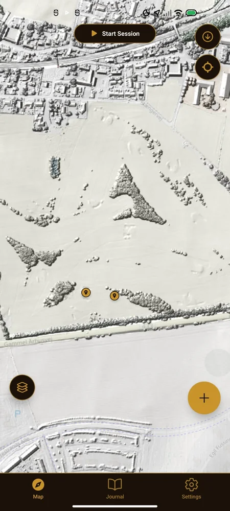
What it does
The tools you actually use in the field — not a feature list for a brochure.
LiDAR terrain
Spot barrows, hollow ways, and ploughed-out features that aerial photos hide. Powered by Dataforsyningen's national elevation model.
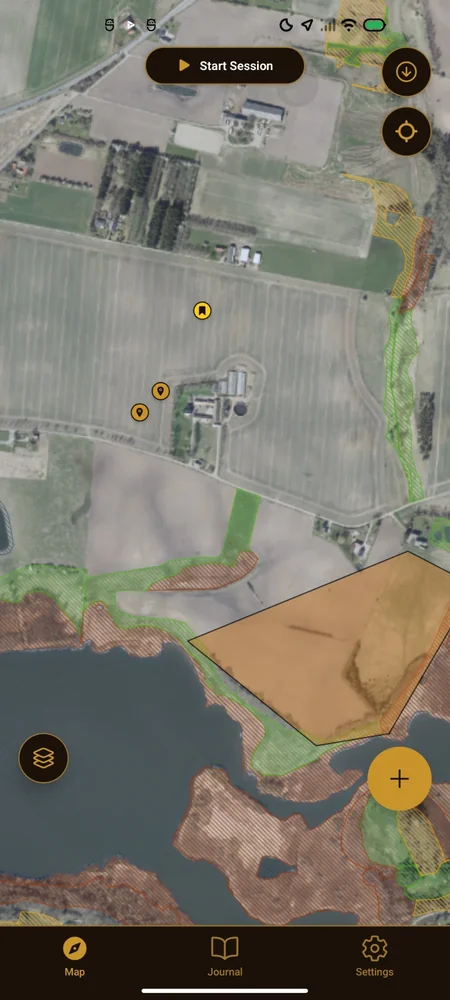
Historical maps
Toggle between 1800s, early-1900s, and modern aerial imagery in a single tap. See where the old farmsteads, roads, and fields actually were.
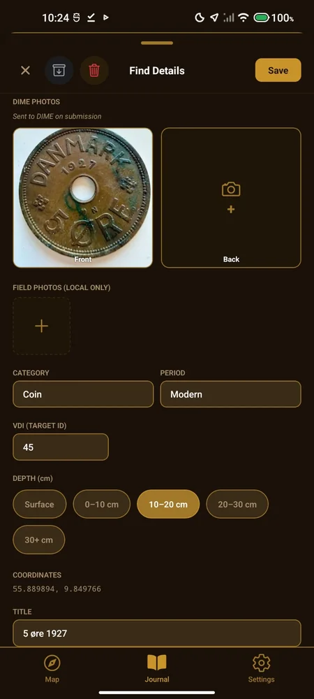
Find journal
Log finds with photos, depth, notes, and exact coordinates. Stays on your device until you decide to submit to DIME.
Protected zone warnings
Fortidsminder, beskyttede sten- og jorddiger, and kulturarvsarealer rendered on the map. Detect responsibly, stay legal.
DIME submission
Submit finds straight to the national metal-detecting register, pre-filled from your journal entry.
Pricing
The core app is free. Muld+ unlocks LiDAR terrain, historical map layers and offline downloads.
Free 7-day trial on yearly, billed through Google Play. See full pricing and what Muld+ includes →
Frequently asked questions
Where can I use a metal detector in Denmark?
On private land with the landowner's explicit permission, and outside protected zones (fortidsminder, beskyttede sten- og jorddiger, kulturarvsarealer). Beaches and state forests have additional rules — always verify locally. The app shows protected zones on the map, but the legal responsibility is yours.
Is the app free?
The core app is free: aerial map, protected-zone overlays, GPS session tracking, DIME submission, and a find journal with photos and notes. Muld+ unlocks LiDAR terrain, the 1800s historical map layers, and offline map downloads.
What is DIME, and do I have to use it?
DIME is the official Danish national metal-detecting register, operated by Aarhus University and Moesgaard Museum. Danish law requires reporting finds of cultural-historical significance ("danefæ"). DIME is the standard way to do it. Submission via Muld is opt-in per find — you decide what (if anything) leaves your phone.
Does it work offline?
Yes. Your finds, photos and session tracks stay on the phone and need no connection. Offline map downloads are a Muld+ feature.
Is there an iOS version?
Not yet. Muld is Android-only at launch. If you'd like an iOS version, mail hello@muld.dev so we know there's demand.
Built for serious detectorists
Most detecting apps are either generic loggers or wrappers around a single map source. Muld is the opposite — a focused tool for Danish hobbyists who want to find real things, respect the law, and submit properly to DIME.
No ads. No tracking. No selling your finds data. Your photos and notes live on your device by default; you decide what (if anything) leaves it. The only personal data we need to create an account is your email — no name, address, or phone number. Compare that to most detecting apps.
Detecting in Denmark is regulated. You always need landowner permission on private land, you must report danefæ to the National Museum, and you must keep clear of protected zones. Muld helps with all three — but the legal responsibility is always yours.